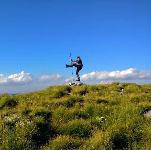

Via Dinarica White Trail Hike 2017.
I first read about this new trail in Outside magazine, where they called it the “Best New Trail of 2014” Well, not only did I like hiking, but I especially like new trails and had always dreamed about an exciting way to see eastern Europe and the former Yugoslavia. The Via Dinarica fit the bill perfectly as it would span 5 of the countries of the Balkan peninsula: Slovenia, Croatia, Bosnia/Herzegovina, Montenegro and last but certainly not least: Albania!
So, I read up on the history of the area, the new trail, and built a website to entice some experienced hiking friends of mine to join me, and sent out the invitations.
Two experienced hikers were lured in along with me and the planning began in earnest.
Skip ahead 5 months later and we all hooked up in Slovenia to begin.
Christine (my niece) and I rendezvoused in Vienna, Austria, then took the train and bus and arrived in Postojna, Slovenia where we met up with Ray and Shagg coming from Trieste, Italy. Ray had just raced in the Swiss Extreme Ironman about five days before with Shagg, Diana and Kig (Ray’s girlfriend), supporting him.
Day 1 July 3rd, The Hike Begins.
Slovenia
We had booked a large house on airbnb to organize our gear and buy our stash of food for for the first 2 or 3 days. We walked down to the center and village square where there was a show going on and had a great meal complete with decantered wine, and HUGE burgers
. 
Christine holding a nice bottle of red wine at the restaurant in the town square
That night, we called a taxi and had him drive Ray, Shagg and I out to Predjama, about 10 kilometers away from Postojna, where the trail actually starts right next to the ancient castle there, in the small village.

Ray, me and Shagg in Predjama at the start of the trail
It’s all a road walk back to Postojna so, Christine stayed with her new friend, the owner of the Bed & Breakfast while we went out and did this (a bit dangerous) section as it is on a somewhat busy road with no shoulder.
July 4th Day 2: Got up early, ate and filled water bottles and headed out for the adventure. We didn’t know what to expect but read that it was through woods roads. Well, sure enough, it was all roads, 90% dirt roads and lots of turns so; the GPS was in good use already. We did have a map but soon found it didn’t show everything and we were glad for the GPS and phone app “Outdooractive” (which also gives mileage and comments and a short description of each section) This app is a “Must-Have” in our opinion as these comments and descriptions are normally the ONLY way to find out where the next water is. There are also some descriptions for POI on the GPS (but we didn’t actually find that out till a little later)
Now, Christine had asked that we take it easy on her as she is a school principal and her summer vacation had just started, so the plan was to camp somewhere near water on that first full day. Well, about 12 kms into it, we came to a house with a cistern and went to get some water. Surprise, surprise: cistern is locked!!!


What? Not good. So, what do we do? Luckily we had enough and shared a bit and got all the way to our next goal which was marked on the map as a small village of Masun.
We got there and saw a house or two and then finally, the restaurant that we had heard about. It appeared closed and I was a little worried as by now we were out of water and in need. Luckily it was open and we went into a cool looking, old fashioned bar and logging knick-knacks everywhere and sure enough, both bar and restaurant were open and they had nice rooms upstairs. We each got one and met up in an hour for our dinner. Now, this place is a bit famous as there is bear on the menu. I ordered the bear and Ray had venison. Both were delish, with lots of sides and dessert was great too.
Christine was a bit ecstatic that her apple watch showed we had hiked 22 miles (35 kilometers). (She was promised no more than 15 mile days to start) But being the good sport she is, she took it well.
Day 3: July 5: Shagg heads home. Today we had to say goodbye to Shagg as he was going to hike back alone, to Postojna and head back to his home in Arizona. He was a good fun and we all were sorry to see him go.
The three of us headed out and finally hit some trail, although still no water sources, which was a little disheartening but we were carrying a bit more after yesterday. The trail quickly petered out and we were soon learning that you had to keep the GPS and phone app handy (routes on each are the same, but the GPS batteries are replaceable and last much longer). I was a little worried because I had left my solar charger back in Thailand as it was 7 oz. and I figured I wouldn’t need it: Wrong. But no problem as Ray and I had both hiked the CDT and were used to bush-whacking and route finding challenges with a GPS. That’s good, because there was much more of the same to come.
Eventually on this day, we ended up at a small village of aprox 7 houses. Again: No water. Nobody around and all cisterns locked. But, I eventually found one that wasn’t . But the water was a good 2 or 3 meters down this shaft and no way to get it out. So, we spread out, looking for a bucket and rope to use and I eventually found an old cement bucket in a falling down garage. And a cheap, plastic rope. So, we threw the bucket down and the water that came up was ice cold, clean and delicious. We treated it, as we weren’t use to cisterns (yet), but didn’t want to camp in town as we didn’t want to trespass on private land. So we filled our water bags (had 2) and walked about 2 kms out of town until we found a flat spot to setup a small camp and cook our first trail dinner. Sound sleep, after another hard day.
July 5th. We knew we would have some excellent scenery today as we were climbing up Mt Sneznik, or Veliki Sneznik at 1776 meters high. It was a beautiful climb with Mali (small) Sneznik about 40 minutes before the summit. 
We were looking forward to talking to someone familiar with the trail, as there were lots of comments in the app about the great couple who were caretakers at this hut. But, guess what? Closed on weekdays! We couldn’t believe it. And not only that, but water was locked up. So, again, no water, and this time we were relying on there being some for sure. Well, OK, we’re learning. Don’t rely on the huts.
We had planned a long lunch break there and enjoy the views, but looking ahead, black clouds and possible thunderstorm coming our way. So, we hustled off the mountain to the north and down a beautiful trail (that eventually ended in another bush-whack) to the Sneznik castle. 
This castle is owned by the government of Slovenia, and has a staff, restaurant, bar, and tour guide for the beautiful castle itself. And WATER! Lots of cold, beautiful water!
And we found out a festival was to be held that night and highly recommended by the staff that we stay and enjoy it. We had planned to resupply in the nearby town, so, said we’d be back, and headed out to see about food.
The following hour was one I’ll always remember and shows the hospitality of the Slovenian and Balkan peninsula people. We were looking for a store and a campground, so when we walked by a house with 2 teenage boys outside, we asked them were we could buy some food. They said, they would drive us to one, but we thought it would be on our trail, and didn’t want to get rides, we were hikers, not hitchhikers. So they gave us directions to the store about 2 kms away and then their mother came out. We asked her about a campground that we had heard about. She said it was quite far but we could set up tents in her back yard. She would have the boys cut the grass until we got back from the store. We said: Wow! Thanks, but no need to cut any grass, we are hikers and can sleep in the woods if need be. She just smiled.
We went to the local grocery store, that turned out to be typical in this part of the world, a small place that ends having everything you need. Not many choices, but has it all: food, clothing, fuel, wine, rope, hardware, and even ice cream! Great!

When we got back to the house with the friendly family, the grass had been cut, and she made us a huge salad to enjoy before we went to the party up at the castle. The whole family then came out to meet us and watch us eat, and learn about each other’s cultures. We didn’t want to eat too much because the festival also had food and drink and music and a puppet show and more. So, we finally walked back up to the castle and met the singer, who was touring Europe and was from Ireland.

And the puppet-master who apparently was somewhat famous in the Balkans. 
People were so friendly to us and surprised that were Americans hiking there. We don’t think it is a very popular thing to do. Now hunting, logging, gardening, horses, all got these people outside, but camping out in the woods? I don’t think so.
I went back to my tent early as I was tired and woke up the next morning to 2 slightly hungover hiking partners. And then, in the morning, the daughter came out to tell us her Mom had made us all breakfast and we could make ourselves comfortable in their old house across the street. Had a fantasic breakfast with an art show when the daughter brought out her excellent art projects to show us.  What a great family! Thank you so much. (Christine since told me that she sent them a gift, but it came back a few months later, marked “undeliverable”) Bummer!
Later that day, we said goodbye to Slovenia as we crossed into Croatia. Our first country on this hike turned out to be a great one!
Croatia
Day 4, July 6th: A few kilometers after Sneznik castle, we crossed our first international border and said goodbye to Slovenia. Welcome to Croatia. Border crossing went smoothly, but then when I tried to get a SIM card for this country, the PO was closed and the next big town wouldn’t be for a while. Oh well. We wing it.
Another great grocery store in this town named Prezid. Even more crowded with goods than the last one. Happily we found the GAZ canisters here as Christine and I were now sharing her propane stove. (my wood fired stove experiment was a failure) I would take over the GAZ once she left after 2 weeks.
Mostly road walk for this first day in Croatia and we soon noticed how most houses were so beautifully decorated with window boxes full of colorful flowers and trying to outdo each other. And they all had vegetable gardens. Everything was flourishing in the great, sunny weather. 
Ray and I live in Thailand, so, we were happy with the warmth, but Christine is from Maine and it was quite a shock for her.
Lots of horses in the fields we passed also as we would see throughout the whole Via Dinarica. What do they do with all the horses?
The next town we hit was Trsce and we were hopeful of finding a place to get a shower and get cleaned up (it takes a while to get used to not being clean everyday on a thru-hike).
We asked at one place and they were full. We headed up the road towards where our app said there was a mountaineering hut or shelter. Didn’t appear to be too many mountains around so, we were surprised when, after about 1 km., we came to a cabin/house? With some people and lots of cars around. They said they had 40 women staying there and were full. But Christine put on the charm to the caretaker (Polish man?) and he said they’d find room for us. All the women were out on a field trip learning about wild crafting. So, we got our showers, and set up in the upstairs massive bunkroom and Christine set out to do some dishes. Well, that got us all kinds of offers to eat some great stuffed peppers, and fresh bread, etc. Turned out the night was a spectacular one with everybody drinking and laughing a lot and the caretaker finally getting around to cooking dinner over a big fire around 10PM! Great people, great memories and lasting friends from that night and we were a bit sad to say goodbye in the morning. But, we are early risers and the trail awaits us.
Leaving the good stop at Trsce, it was another roadwalk for a while up to a church. It was now Sunday but, no church service. Later someone told us this particular church was only used on special holidays. 
The GPS track from there shows the trail going down right behind the church. We spent close to an hour searching for it, but nothing to be found. So, being the adventurous sort that we are, we just started following the track on the GPS. Every once in a while, we’d see a blaze, but no trail. Eventually, it got really thick with briars and nettles (ouch!). And then we came to a house. The inhabitants knew nothing about the Via Dinarica trail and gave us (badly needed) water. We asked about a place to stay that was in the comments but they didn’t know. They pointed up hill and said: perhaps there.
So, we followed the road up and came upon another great place. This is marked as Hrib on the map, and the campground/partyspot/restaurant we found there was full of big motorcycles and rock music blaring. Lots of biker dudes around and we thought we had walked into the middle of a Harley festival or something. But, the owners came over and said, “help yourself to what you want from the cooler and I’ll be glad to take your order if you want food” Well, of course we wanted food. And maybe a place to stay. He then showed us some small A-frame cabins he was building and said his goal was to have 20 of these and people would pay to use them. When we asked how much, he said free! Well, “free is better than cheap” as my buddy “Rainman” says. So, we settled into a few beers and enjoyed some “Dire Straits/Lynard Skynard/etc” and ordered food. 


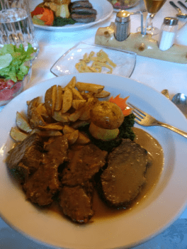
We ate a lot. Meat and bread is basically the menu in this part of the world in most of the restaurants.
(and beer). We stayed in the A-frames and also enjoyed a tour of the old house, complete with wine cellar and then a fantastic breakfast before we were back on trail and on our way.
(Every few days, we recorded our whereabouts and thoughts. I will add them here where they belong in time and they will always be in italics, straight from the recording, along with the date when I know it.)
July 10: “Seven days More than 120 kms. We finally saw our first running water, after we descended down to the large river Kupa” 
 about 7 km after
So here we are at the Visitor’s Center. It says: “Birth House of the River Kupa”
But we finally hit some running water. About 6 creeks this morning and the big river that we are following upstream, heading due south. More comments from our recording we made that day:
Teen said “Wicked good , wicked good.”
Ray said “We were offered schnapps and coffee this morning when we morning at the river, but no hot dogs”.
Teen; “Oh yeah. Josep, had the schnapps. Nice guy. “
Just uphill from the river, after ascending some nice steps,
We got to the visitor’s center and met the caretaker named Barbara.
She sold us passes for the Risnjak National Park, and then gave us a tour of the nearby museum as well as called ahead to book us a room in the National Park’s hotel and restaurant. Once again, great food.
The next morning, we headed up the mountain  and had high hopes once again of finally seeing the inside of one of the “huts” The Risnjak hut is at the top of the long climb.
It got colder and colder as we ascended and when we got to the top, guess what? Closed. Locked. No water. Mmmmmm. We were told this one would definitely be open. After being informed from 2 other hikers we saw up there, they said: “Even the caretakers need a day off sometimes”. 
Oh well. Time to get off the mountain as we it was cold and windy.
Next mountain is Tuhobic and it was a beauty. No hut to get anxious about, just a great 360 degree view, but again a windy summit. 
An interesting phenomenom happened to us on the descent, here is the recording we made about it:
Tuhobic descent Ray July 12: “When we came off the summit of Tuhobic, maybe 1 or 2 km down the ridge, all of a sudden the Garmin GPS showed us that we were on the A6 and Glenn’s app for Google Maps, also showed that were smack dab on the A6, but we could see the A6 far away. After hiking for another 20 minutes or so, we were still on the A6, the GPS seemed to be tracking but the underlying map seemed to be wrong”
We figured it out the next day. We must have been right on top of the highway’s tunnel 300-400 meters below us. We could see the big highway far away, but had no idea it was directly under us.
We got some rain that night and hurried into a small village and were hoping for a BnB
 or “Apartmento” to dry out and hitchhike to a bigger town the next day to resupply the next (longer) section.
Lo ad Behold, just as the rain got harder, there was a place with a couple in the garage. When we asked if they had a room or apartment. empty, they said: It’s not cleaned up from last night.
We didn’t care, so (actually it was spotless! Christine found some food in the cupboards and cooked us a great meal. The place was beautiful with artwork carved out of wood and a huge Jacuzzi.
(and people think we rough it out here!)
Soon after this, while resting near a mud puddle, where Christine needed water badly and we got some video of her filtering and double filtering this suspect source (tadpoles galore), we met our first hikers on the trail. 2 guys who were out for a few weeks. One from Belgium and one from the Netherlands. 
We hiked with them the rest of that day and did a little bushwhacking and then down a ski slope into the next town.
This is where we had to say goodbye to Christine as she only had 10 days total with us and would head back to Vienna. Goodbyes are always tough and this one especially because we had such a great time. 
Here we are having our last meal and drinks together along with the European guys.
Next day, well I will transcribe exactly from our recording we made.
July 15: OK, Today is Saturday, July 15, and We just started section 7 coming off a mountain that never gave us the view (YEHAW in background) But I want to tell you about: Since we left Christine yesterday in Tuk, early morning, we left her about 7 am. Because we didn’t know what’s coming up. And it turned into the most rugged day so far. First 10 km was road walking and then it headed up and then we had 8 km of this white rock, beautiful spears, with small chimneys and cables and ladders and just amazing, almost rock climbing.
We had to some rock climbing moves here and there, and it was just amazing. We have some great pictures.


Anyway, we saw 3 cabins yesterday and we actually stayed in the 3rd one. One was called Ratco, and it was in a cave, the shelter was built in a cave and the next two were in the same spot basically, 50 meters apart and they were called Bijele Stijene 1 and 2. Number 1 had great water, it was a cistern but it was good with a bucket. No. 2 was a cabin with a nice stove in it (numbers are reversed)) The one we stayed in had a nice stove and a nice pile of firewood there, and it was cold. Like Ray even thought he saw some snow flurries. This is July 14th. So, we built a little fire in there. We thought, well, we’re not gonna see the Dutch guy and Belgium guy again, because it was really rough hiking. We got there at 4 o-clock and normally we hike till 7 or something but, we decided to stay. Ad what do you know, here come the 2 guys about 2 hours later, so, we went to sleep about 7 oclock . Ad all these people came in cause it was Friday night and they all drank outside till about 2 or 3 in the morning. They went to bed.
Now this place only had about 8 bunks. But I counted 7 packs besides our s this morning but , they had a lot of booze out on the table this morning.


So, we headed out into some more overgrown (or non-existing) trail and many flowers, bees (easy to see why there is so much honey for sale on the roads on weekends around here) with a goal of staying in the schoolyard in the small town of Kriviput.
On the way there, we were walking down a road and right past a restaurant that was open. Wow, if we had known. Of course there’s no guidebook for this trail, so, we looked at each other and didn’t hesitate to walk right in and sit down. The waitress came over with a 3 or 4 page menu and we were seeing salads, and soups, and burgers and …………..well, of course the only English she knew was the word: MEAT! So, OK, I guess we’ll take the meat. And a bottle of sparkling water of course. When the food came, it was a piece of bread with 12 sausages on top. 12! For each of us. So, we ate meat.
 Then a girl was cookin more meat out back behind the restaurant, this time some sheep.
Moving on, we made it to the town of Kraviput only to find that the school yard was quite a mess and old blacktop with no tent space. My tent is a tarptent and I need to get some stakes in the ground.
So, it wasn’t the easiest setup but we made it. 


Next we walked along beautiful ridges, looking down to the Adriatic sea below.
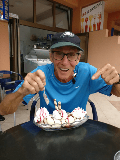
the weather had turned colder this day and windy too. We finally got to the pass with the big road about noon. And tried hitchhiking a bit, but no good. So, we ended up walking the 14 kms down to the beautiful coastal town of Senj where we had to resupply. We got a room, Ray went swimming in the cold water, and lots of food with ice cream for dessert.
Next day, we paid someone to drive us back up to the mountains and once again, hiked along ridges looking down on the beautiful sea below us.
July 17th Senj to Oltari
Monday morning, July 17th. We spent last night in Senj. Really beautiful little European town, right on the Adriatic sea. Had the band playing at sunset.


Ice cream stands and restaurants everywhere. So, we did a resupply there and paid someone to take us back up to the top of the morning because yesterday it was a 14 km walk DOWN the mountain.
The day before that, it was Kraviput to the mountain pass above Vratnik, where we headed down from
But today we climbed a mountain and we’re sitting right now having lunch in this beautiful alpine meadow looking down at the sea. We’re up at about 1400 meters, and ah…..it’s been some bushwhacking this morningand some roadwalks but, right now we hopefully have some marked trail for a while. Sometimes it’s marked and sometimes it’s trail, but it’s rarely both at the same time. But ah, we sure are at a beautiful spot right now.
Eating good cheese and bread from town and we’ll soon be in Oltari, and that will finish this section 9.
Then on to some more of the beautiful white rocks in Velebit National Park.
This time, we were on a trail that was amazing.  Built in the 30’s by a lot of hardy men as this was really a lot of work, to make a trail through this diverse land. My feet were getting sore as the rocks were average of about golf ball size, only sharper! And it was ALL rock!
This went on for most of the afternoon, but we ran into quite a problem near the end of this section.
When we downloaded and installed the GPX track on our GPS’s back a few months ago. We didn’t realize that the data we uploaded to our GPS’s ended here. WE ONLY HAD 1/3 of the trail! Although the Outdoor Active phone app has the same track (and the whole trail) the batteries lasted so much longer in the GPS. Now, this trail is beautiful at times, but at other times, it is bushwhacking through some tough stuff and no trail at all. So, often times, we had the GPS on all the time, and the phone just wouldn’t last. So, we needed to do something.
The girl at the hotel down in Senj was very friendly, and we needed a laptop to transfer, so, we got to the next hut on the trail, and bummed a ride back down to the town of Senj. The woman at the desk was quite surprised to see us and let us use the laptop behind her reception desk. It took a few hours, and luckily Ray is a genius when it comes to computers, so we were able to download them without using the software from Garmin.
Took the rest of the day, so we enjoyed another night in Senj and another 6 scoops of ice cream each!
Once again, paid her uncle to drive us back, this time a little further as we needed to go back to where we left off.
GPS’s fully loaded, in hand, we set off once again the next morning. Hiked to the hut of “Alan” which was full of people and a very friendly caretaker.


He cooked us a big pot of soup and gave us a room all to ourselves upstairs with a view. We told him we would be leaving early as we like to get on the trail at sunup and he didn’t need to get up to see us off. He said, oh no, I make you breakfast first. And he did. Once again, great hospitality in this part of the world! We loved it.
Here’s another entry from our recording made in this area:
“It is now July 19th.
I’m sitting here looking down at the beautiful Adriatic sea and about 30 islands.
Maybe that’s Italy in the distance.
It’s 7:30 I the morning.
We stayed at Alan hut last night, which was a great stay.
Big hut! Really nice guy running it.
Fed us a great sausage soup last night with bread. And eggs with chopped up bacon and cheese this morning, very strong coffee.
The Velebit National Park has just been awesome.
Yesterday we stopped at this small little cabin, I was think it was called Rosival.
We came across this trail that was 9 kilometers long, that was built in the 30’s and it was just spectacular trail building, that they did in there.
I can’t imagine how they built that, without about 1,000 people for 3 years, because it was just stone walls holding up the trail which would have been cliffs without the walls and trail building there.
And it was hard walking because they were like baseball size rocks with many of them pointed. Everywhere.
Now today, we are half the trail and half rock and we have the Adriatic sea to our right, which is east. And it’s really spectacular.
Here comes Ray down the trail and we’re hoping to hike to another hut tonight.
We’re carrying food but not eating much of it as we’ve been finding huts and towns and stores that we didn’t know about.
A guidebook would be nice. But not knowing what’s coming up is nice too.”
It’s now July 21st.
“Last night we stayed in a brand new hut. Beautiful. Called Zdrilo. 
Brand new, architectural design. Really steep walls. Had a little tiny solar panel above the window. And we charged our phone. Had an electric pump for the cistern but the cistern was almost dry. So, we got a few litres but this morning we couldn’t get any more.
We’re heading to Sugarska Deliva. Which is a hut which is no longer in existence but there’s water there.


Yesterday we left the town of Karlasbad, back up to BaskeOstarije, the hostel. And commenced this section
It’s been tough in here. UP and down, up and down all the time. Faint trail. Good markings though. Lots of blowdowns.
Rocky, beech tree forest. Just nothing consistent, it’s either up or down and no one has maintained it for a while. So it’s tough.
But beautiful. Over and out.”
July 23 Stuge
(big wind in the background)
“Here we are on top of a mountain (ineligible)
We stayed last night at Stuge. Which was a bit rundown and too far from the water. And ah: 2 hikers came In late, one came in just as we went to bed. The night before that, we stayed at Stat (?) Where there was a pump in a cave there but a girl hiker there who was staying there who had drained it. We waited and it recovered enough for a few litres. It’s been tough hiking. Beautiful scenery.
Nobody out here, except those people we saw at the shelters. We don’t see anybody on the trails . ever.
Anyway, we’re heading downhill from here. This is the highest point of our trip so far.
We entered a National Park called Palenka .We entered yesterday. It’s been nice. Very nice.
But we have some dark clouds coming in so, we need to move off this mountain.”
More beautiful ridgewalking looking down on the sea below us until the next section. Here we ended up at Tulove Grede which turns out to be the site of a famous German movie about an American Indian.

There were a few RV’s there as German people like to come to this beautiful spot to camp and climb some of the big rocks on the movie site. We sat down and got to talking to a family and they were going to head down to town shortly so we waited. Cold beers, good conversation and a ride! To town!
Now the next section was closed due to land mines that hadn’t been cleared yet from the war 20 years ago. This part of the world had a terrible war that divided up the country of Yugoslavia into: Croatia, Bosnia, Montenegro, Albania, Kosovo and Serbia. (possibly Macedonia and Moldova too, not sure as we wouldn’t be hiking in those)
And land mines seems to be the way that both sides fought this war. We saw many bombed out villages with falling down houses, with no one around. Killed? Or moved away from bad memories? Who knows. But we figured this must be the reason why not many people were hiking here. We liked having the mountains to ourselves, but it was very strange. To be in such a beautiful place, with total silence in villages and beautiful views with no one around. We started seeing some signs for land mines, so made sure to stay on the trail now. Most of the war and killing were done in Bosnia and we were getting closer to that country.
So, we had to skip a piece of this trail and hopefully they will get this section cleared soon. We ended up getting a ride from the restaurant owners son in the next town, back up to the trail where we would continue.
Now the towns were looking more rough and more eastern. (Turkish? Russian? Greek?) I don’t know but there was a change from the western European look we had been seeing.
Beautiful treeless hiking up here with views all around.

We took many 360 degree videos to post to our FB page.
Now about this time, we’d been on the trail almost 3 weeks and hadn’t taken a day off. Since the next day was my birthday, I let Ray know that for my birthday, I would REALLY like a day off. So, we did, and went to the town of Saline, again on the Adriatic sea. Ray went for a swim, I ate lots of ice cream and the town was great. Not as big as Senj, but just as nice and the water was so clean.
In the next section, we would be starting a big climb up Dinara and were warned (by comments on the app) that it was rocky and steep.
But it started out on a shadeless roadwalk that took us through a very small village (8 houses? ) and some old style trucks, houses, bee hives, and then some construction workers we tried to talk to. No English, but a little German which Ray knew slightly. There was a big mountaineering hut at the far end of this village with a phone number written on the sign. Still had cell phone signal, so we called and asked if there might be a key we could open the door to stay in there. The woman was very nice and spoke good English. She said no, but there is a nearby cabin we could sleep in, so I looked around and there was one small rustic cabin that was unlocked. So, we set up there and cooked dinner and enjoyed the beautiful view. This was one of my favorite places to camp on the whole trail.

 And that night, I took a walk and saw what looked like a wild dog or coyote to me.
Here’s our recording from that night:
July 25th (Ray talking this time)
“We just came into a beautiful meadow. But, shit started happening. On the way here, we saw “bag man” , with a dead dog under his arm. And we decided not to approach him.
He came out of his vehicle and quickly entered the house, packing the wounded or dead animal. Then we were attacked by a goat. He looked like he hadn’t seen a human for years.
Then we came to a little well, almost. And Glenn descended a ladder to this algae pool where he filled up our bottles with green water. But we ended up not drinking that. Because then we went up to some beautiful hut, and out of the woods, and I’m not making this up, a guy emerged wearing army fatigues, a white dress shirt that could have gone with a tux, and a leather vest with fringe. Yeah, you heard me right, six inch fringe. He sat down next to us at this picnic table, and didn’t say anything. We tried to break the ice but, more or less he just grunted and smiled. And then he pulled out a flask of plum brandy and I took a shot of it, he took a shot. Glenn went and reconnoitered the area for tent sites. I was kind of worried I might be attacked.
Then Glenn called a lady from a phone no. on the cabin and she said the big hut wouldn’t be open but we could get in a small hut here that’s unlocked. Then the guy pulled out his flask again, took another shot and then he walked away. Then he got up and left.
So, now we are back at the small hut, Glenn’s cooking dinner, I just swept it out.
It is a beautiful meadow and maybe the rain will hold off.
The cabin is from 1850, so it’s 167 years old and it looks it. The roof might leak if it rains. Over and out!”
Although it was still only July, there were people out cutting firewood this time of year as it seems everyone heats their homes that way. Old tractors, pulling rustic old wagons, loaded heavily with beech and other hardwoods for the winter.
From here it was mostly trail and then the aforementioned rocky section to the top.
Great climb, great peak, great day! 

On the descent, we passed an old castle from the Ottoman empire. At least 500 years old. It was pretty cool and next to a small town with another closed hut. We did meet some old folks sitting on their porch in this town and had a conversation, again in German. They were pretty surprised that we were hiking from Slovenia to Albania. We would have liked to ask more about the war as we were seeing more and more signs of its destruction (the recent one, not the Ottoman one). We thought this is going to be great, with swimming holes, and trails. But no, it’s a road walk and no views of the lake. Bummer and it was dry. So, we needed some supplies and water and finally found a turn off to a town. But where’s the store? Finally we saw a stack of beer cases piled up high and said to each other: “That looks like a place we could get some drinks at least, and hopefully some information on a place to camp” Sure enough, we had guessed right on a few forks and this was the local grocery store, which also seems to mean where the older men hang out most of the days and drink their pivo (beer). We drank a lot of ice teas and sodas and bought some food and found out we could possibly find an “Apartmento” or guest house in a few more kms.
We found a retired army officer who was fixing up a house to turn it into a bnb. We asked about food, and he went inside and cooked us a big meal of soup, ham, great cheeses, and veggies. (did I say veggies! This was a first in a long time) He then let us take showers and showed us a room with a beautiful view of the big lake. 
Continuing our roadwalk from there, we passed a monastery. We walked in and there were a few people around. Some in monk garb (black robes with hats) and one guy was in painting clothes and we watched him painting a mural on the ceiling of a small room. Talking to him (in English) he told us he was a Serb and they had inhabited this part of Croatia before the war. But now he lived in Serbia which was probably 500 kms from here as the crow flies. 

Next we came around a town and saw the lake to our left and it looked awesome. Then there was an RV camped next to it, and when we got there, there was an arm of the lake that jutted into a beautiful cove and swimming hole. We indulged! 

Then talked to the young couple for a while there as we ate our lunch. They were testing out the RV for an extended trip around Europe. This was their maiden voyage with it. They both were from the area but worked in London so, English was spoken fluently. They told us a bit about the war and explained that’s why you don’t see many people. They either were killed or left to find more peaceful places. Almost everyone who talked about the war with us, would end their narrative with the words: “It was complicated, and we’re all glad it’s over!”
Now it was Ray’s birthday and he too got a nice surprise: We passed a creek that had a box of beer cooling away in it. A man nearby told us he was getting the site ready for a big party that weekend and we were welcome to help ourselves to a cold one. So, here’s Ray enjoying his birthday beer in the ice cold creek (my feet turned numb in less than a minute!) 
Next town, Sinj, was a big one, so we got a room and then found out that a big festival was to be held that weekend in the town. They were re-enacting a battle with jousting (horses charging each other with long lances) and they would be practicing that evening. So, after a great meal, we went down to watch.
It was pretty amazing with these men riding horses full speed, with 4 meter long weapons, trying to spear a ring the size of a donut. Only one guy got the middle hole of the donut, that we saw. I was very impressed! 
Here is where Ray’s 2 friends from his teaching days in Georgia, met up with us and hiked for 2 or 3 days. Unfortunately, this section was a lot of roadwalking and dry but his girlfriend was very good looking so, she had no problem getting water. (even had ice in it!) We camped near a deer farm and unfortunately, a dog barked throughout the night as we camped at a nice pavilion that had been built for hikers. 

Now it was time to say goodbye to the longest country of any that we would have on the Via Dinarica trail.
I’m going to finish this blog entry here as the trip was a long one. I’ll break it down into countries with this one being Slovenia and Croatia. Stay tuned to the next leg of our journey: Bosnia and Herzegovina.
Also, I made an 18 minute video about the entire 52 day hike and it can be seen here on vimeo:
https://vimeo.com/237719158
I